| View previous topic :: View next topic |
| Author |
Message |
onemorecast
Finger Mullet
Joined: 22 Jul 2012
Posts: 24
Location: Corpus Christi
|
 Posted: Sun Nov 30, 2014 2:24 pm Post subject: kates hole Posted: Sun Nov 30, 2014 2:24 pm Post subject: kates hole |
 |
|
Can anyone clear this up for me? Is the area behind the church on 361 just south of the powerlines kates or deadmans??
_________________
FISH ON!!! |
|
| Back to top |
|
 |
PanamaYak
Flour Bluffian in training
Joined: 08 Mar 2006
Posts: 261
Location: C.C. TX
|
| Posted: Sun Nov 30, 2014 3:17 pm Post subject: Your answer |
|
|
The hole behind the blue roof church (Island in the Son) & thru which the power line poles run is Deadman's Hole.
Kate's Hole is north of the power lines and can be accessed thru west Mustang Island State Park.
Deadman Hole is at the very north end of Kate's and separated from Kate's by a large flat.
_________________
HooYah!
PanamaYak |
|
| Back to top |
|
|
onemorecast
Finger Mullet
Joined: 22 Jul 2012
Posts: 24
Location: Corpus Christi
|
| Posted: Sun Nov 30, 2014 3:23 pm Post subject: |
|
|
Thanks thats what i was figuring but I've heard different although most people think this. Thanks again
_________________
FISH ON!!! |
|
| Back to top |
|
|
wannafish
Flour Bluffian in training
Joined: 11 Mar 2006
Posts: 360
Location: CC
|
| Posted: Tue Dec 02, 2014 9:05 pm Post subject: |
|
|
I disagree, Kates Hole is north & south of Deadmans (2)
[url] [/url] [/url] |
|
| Back to top |
|
|
OSOMURF
Flour Bluffian in training
Joined: 14 Jan 2013
Posts: 253
Location: Corpus
|
| Posted: Wed Dec 03, 2014 6:50 am Post subject: |
|
|
| Hey Wanna, where did you get that map? |
|
| Back to top |
|
|
TheRealLagunatic
Flour Bluffian in training
Joined: 02 Sep 2013
Posts: 268
Location: Flour Bluff
|
| Posted: Wed Dec 03, 2014 6:58 am Post subject: |
|
|
| Where did you get this map ......is the ink even dry yet ? |
|
| Back to top |
|
|
SilverTundra4X4
Horse Mullet
Joined: 13 Nov 2012
Posts: 134
|
| Posted: Wed Dec 03, 2014 8:11 am Post subject: |
|
|
so theres a Deadman and Deadman's hole!?!?!?!?
Sheeshhhhhh i thought there was only one which was right behinf the church along the powerlines .... how deep is the water in thet "holes" ?
Wadeable? or best fished with yak |
|
| Back to top |
|
|
MECE
Horse Mullet

Joined: 23 Aug 2013
Posts: 187
Location: Corpus Christi
|
| Posted: Wed Dec 03, 2014 8:53 am Post subject: |
|
|
| SilverTundra4X4 wrote: | so theres a Deadman and Deadman's hole!?!?!?!?
Sheeshhhhhh i thought there was only one which was right behinf the church along the powerlines .... how deep is the water in thet "holes" ?
Wadeable? or best fished with yak |
Not sure on the actual depth of the water but its better fished on a kayak, I have waded the area along the edges of both and its very soft mud around most of the edge so not a very comfortable wade. I have done better when on the yak than when on foot. All you ever here is that these areas don't produce good fish but for me it has been the complete opposite. I have pulled my fair share of Flounder, Reds, and Drum from those areas. I recommend it as a good spot for anyone that is a beginner on the yak and just getting into the sport. Lots of shallow flats around the holes in case wind is high and unable to paddle to shore or if you flip the yak and cant get back in. Overall easy area to get out of a jam if you make a rookie mistake on the kayak. My wife and I went out there one time and the wind was very strong she couldn't paddle back to shore. I tied a rope on to her yak and paddled as hard as I could and pulled her across the hole with my yak. As soon as I got across the hole I jumped off in the flat and pulled her in. We walked the kayaks back into shore. |
|
| Back to top |
|
|
cabrego
Pony Mullet

Joined: 20 Aug 2014
Posts: 99
Location: McAllen, TX
|
| Posted: Wed Dec 03, 2014 9:42 am Post subject: |
|
|
here is where you can find similar maps, if you zoom in--you can see depth estimates.
http://www.stxmaps.com/ |
|
| Back to top |
|
|
RPool
Member White Shrimper Boot Club
Joined: 06 Mar 2006
Posts: 795
Location: San Antonio; Padre Island
|
| Posted: Wed Dec 03, 2014 10:01 am Post subject: |
|
|
| If you are new to fishing that area and are on a kayak, please take note of the very shallow channel, marked by white stakes, that connects it to the ICW. (Note - the yellow stakes are not the channel) Boats entering and leaving Kate's/Deadman's from the ICW have to stay on plane to get in and out - not being rude (those that are using the channel), just can't shut it down. I have felt bad in the past when kayakers sit and fish the channel area but there is simply no choice but to keep it on plane. Once in the area, I try my best to give kayakers and waders plenty of real estate. Enjoy. |
|
| Back to top |
|
|
apfb
Horse Mullet
Joined: 28 Jun 2014
Posts: 163
|
| Posted: Thu Dec 04, 2014 12:51 am Post subject: |
|
|
| wannafish wrote: | I disagree, Kates Hole is north & south of Deadmans (2)
[url][/url] |
That map is completely wrong on location of kates and DeadMAN. Where it is labeling Deadman is nothing more than a large sand flat and oyster bar. Unless your in a skinny boat, your gonna be calling seatow north of the crane island and the large duck blind built by Mr. Austin.
The large hole is Kates, to the EAST of that hole is DeadMAN
The church hole is deadmanS
Google maps satallite dosent lie.
Panamayak is correct. |
|
| Back to top |
|
|
wannafish
Flour Bluffian in training
Joined: 11 Mar 2006
Posts: 360
Location: CC
|
| Posted: Thu Dec 04, 2014 8:53 am Post subject: |
|
|
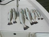
I have ran in there from the ICW cutting in between the 1st (2) spoil islands when entering the ICW from CC Bay. Boats I have done that in are, 16' Van Noy Skiff & 19' Pathfinder Tunnel. Fished it a lot from a 12' alum.Jon-Boat put in from the east side of Deadmans. We used to make that cut in and angle to hole via route between the two islands.
Its been a while tho' since fishing there,be "VERY" careful when running in from ICW,always explore new areas like this on High Tide and have a buddy and a plan.
[img] [/img] [/img] |
|
| Back to top |
|
|
RPool
Member White Shrimper Boot Club
Joined: 06 Mar 2006
Posts: 795
Location: San Antonio; Padre Island
|
| Posted: Thu Dec 04, 2014 10:02 pm Post subject: |
|
|
| And you are running over fish when you come in that way. Much better to come further south and come in with the white stakes. |
|
| Back to top |
|
|
apfb
Horse Mullet
Joined: 28 Jun 2014
Posts: 163
|
| Posted: Thu Dec 04, 2014 10:56 pm Post subject: |
|
|
^^ exactly
I know the Vanoy skiff that I witnessed 2 weekends ago trying to get to kates from the bay found out very quick that that north sand flat is SKINNY! Told my gf "hey, watch this pendejo" Sure enough, natures e-brake was engaged quickly. My boat drafts maybe 5" of water and it was skipping the bottom. |
|
| Back to top |
|
|
Crash
Flour Bluffian in training

Joined: 03 Feb 2012
Posts: 299
Location: Flour Bluff
|
| Posted: Sun Dec 07, 2014 5:27 pm Post subject: |
|
|
Rule on my boat is if you say "Lets go to dead man's" you go for a swim.
Twice while running the stakes I have gotten stuck hard due to other boaters and Kayaks. So I don't even try anymore not worth the trouble.
_________________

Me and DR fishing Pita Island November 2010 |
|
| Back to top |
|
|
|


